
File:Biafra independent state map-en.svg

Captions
Captions
Summary
[edit]| Description |
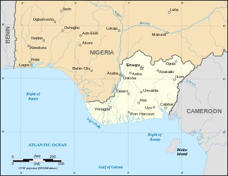
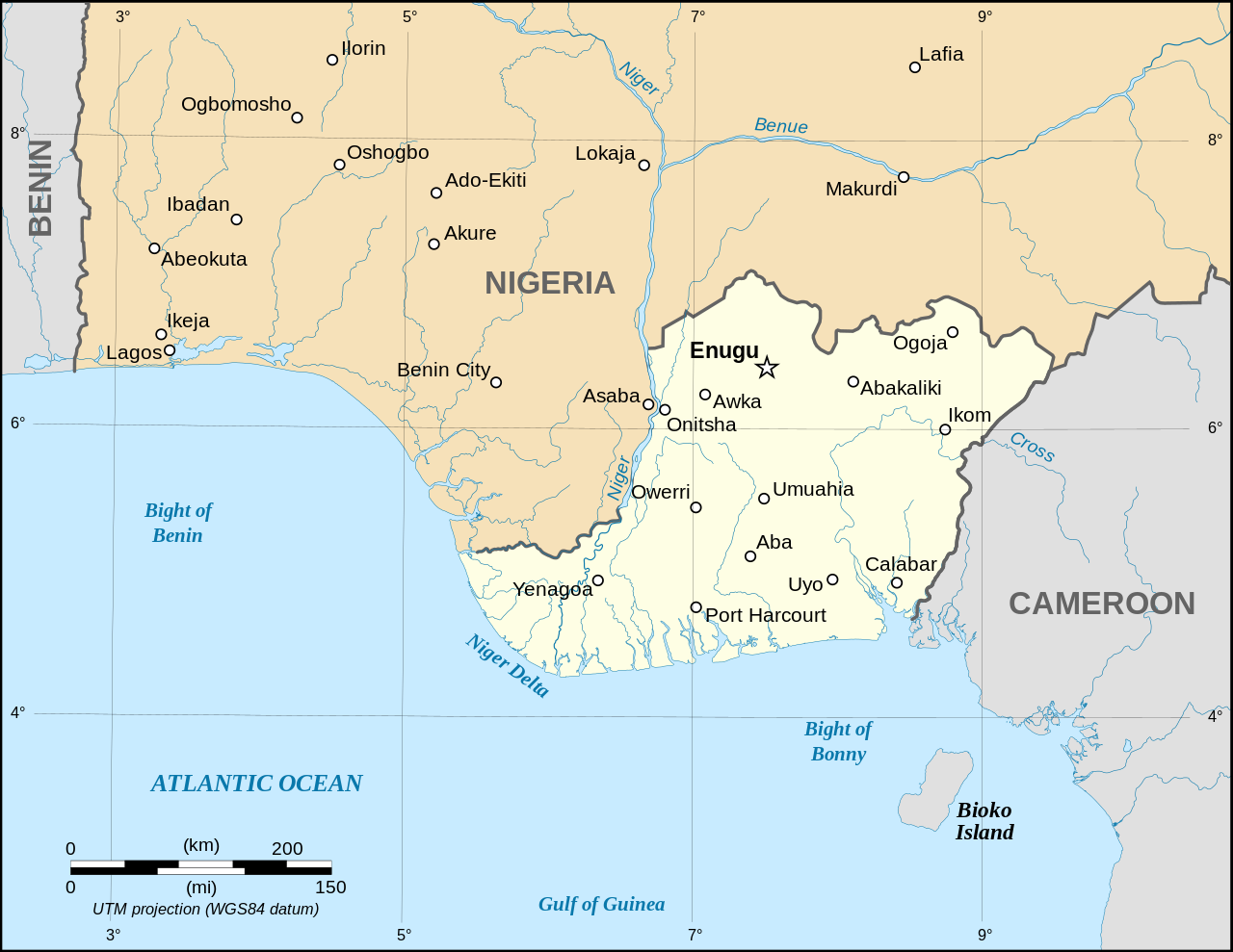
English: Map of the secessionist state of the Republic of Biafra (1967 – 1970) as in May 1967.
Note: The western boundary may not be accurate due to the low precision of the reference maps used which are also contradictory. UTM projection ; WGS 84 datum Français : Carte en anglais de l'État sécessionniste de la République du Biafra (1967 – 1970) telle qu'en mai 1967.
Note : La frontière Ouest peut ne pas être précise en raison de l'imprécision des cartes de référence qui sont aussi contradictoires. Català: Mapa de la república de Biafra en el maig 1967. |
||
| Date | September 2008 (new version) | ||
| Source |
Own work based on:
|
||
| Author | Eric Gaba (Sting - fr:Sting) | ||
| Permission (Reusing this file) |
|
||
| Other versions |
File:Biafra independent state map-en.svg contains 2 translations.
|
||
| SVG development |
|


Licensing
[edit]

|
Permission is granted to copy, distribute and/or modify this document under the terms of the GNU Free Documentation License, Version 1.2 or any later version published by the Free Software Foundation; with no Invariant Sections, no Front-Cover Texts, and no Back-Cover Texts. A copy of the license is included in the section entitled GNU Free Documentation License. |
| This file is licensed under the Creative Commons Attribution-Share Alike 3.0 Unported license. | ||
| ||
| This licensing tag was added to this file as part of the GFDL licensing update. |
- You are free:
- to share – to copy, distribute and transmit the work
- to remix – to adapt the work
- Under the following conditions:
- attribution – You must give appropriate credit, provide a link to the license, and indicate if changes were made. You may do so in any reasonable manner, but not in any way that suggests the licensor endorses you or your use.
- share alike – If you remix, transform, or build upon the material, you must distribute your contributions under the same or compatible license as the original.
File history
Click on a date/time to view the file as it appeared at that time.
| Date/Time | Thumbnail | Dimensions | User | Comment | |
|---|---|---|---|---|---|
| current | 19:21, 15 September 2023 | | 1,100 × 850 (472 KB) | Glrx (talk | contribs) | 256 kB workaround // Editing SVG source code using c:User:Rillke/SVGedit.js |
| 10:59, 15 September 2023 |  | 1,100 × 850 (472 KB) | KajenCAT (talk | contribs) | File uploaded using svgtranslate tool (https://svgtranslate.toolforge.org/). Added translation for ca. | |
| 04:51, 3 September 2008 |  | 1,100 × 850 (455 KB) | Sting (talk | contribs) | New version using the NGDC GSHHS and WDBII data ; new standard colors | |
| 17:54, 12 December 2006 |  | 1,100 × 850 (163 KB) | Sting (talk | contribs) | {{Information| |Description=Map of the secessionist state of the Republic of Biafra (1967 – 1970) |Source=Own work<br/>Background reference map : Microsoft Encarta atlas (1999 edition)<br/>Biafra independent state borders reference maps : [http://www.bi |
You cannot overwrite this file.
File usage on Commons
The following 16 pages use this file:
- Atlas of Nigeria
- Biafra
- User:Magog the Ogre/Multilingual legend/2023 September 11-15
- User:Sting/Gallery: Regional maps
- File:Biafra independent state map-ar.svg
- File:Biafra independent state map-de.svg
- File:Biafra independent state map-en.svg
- File:Biafra independent state map-es.svg
- File:Biafra independent state map-fr.svg
- File:Biafra independent state map-it.svg
- File:Biafra independent state map-jp.svg
- File:Biafra independent state map-mk.svg
- File:Biafra independent state map-ru.svg
- File:Biafra map.PNG
- Template:Other versions/Biafra independent state map
- Category:Nigerian Civil War
File usage on other wikis
The following other wikis use this file:
- Usage on af.wikipedia.org
- Usage on ar.wikipedia.org
- Usage on ast.wikipedia.org
- Usage on azb.wikipedia.org
- Usage on az.wikipedia.org
- Usage on be.wikipedia.org
- Usage on bn.wikipedia.org
- Usage on br.wikipedia.org
- Usage on ca.wikipedia.org
- Usage on ckb.wikipedia.org
- Usage on cs.wikipedia.org
- Usage on da.wikipedia.org
- Usage on el.wikipedia.org
- Usage on en.wikipedia.org
- Nigeria
- Biafra
- Chinua Achebe
- Nnamdi Azikiwe
- Sam Mbakwe
- List of active separatist movements in Africa
- Postage stamps and postal history of Biafra
- Fall of Enugu
- Biafran airlift
- Insurgency in Southeastern Nigeria
- Blockade of Biafra
- User:Atavoidirc/Seperatists
- User:SafariScribe/Nnamdi Azikiwe
- User:Falcaorib/Nigeria
- Usage on eo.wikipedia.org
- Usage on es.wikipedia.org
- Usage on et.wikipedia.org
- Usage on eu.wikipedia.org
- Usage on fa.wikipedia.org
- Usage on ff.wikipedia.org
- Usage on fr.wikipedia.org
- Usage on gl.wikipedia.org
- Usage on ha.wikipedia.org
- Usage on he.wikipedia.org
- Usage on hr.wikipedia.org
- Usage on hu.wikipedia.org
- Usage on hy.wikipedia.org
View more global usage of this file.