
Category:Maps of Réunion
Departments of Metropolitan France: Ain [01] · Aisne [02] · Allier [03] · Alpes-de-Haute-Provence [04] · Hautes-Alpes [05] · Alpes-Maritimes [06] · Ardèche [07] · Ardennes [08] · Ariège [09] · Aube [10] · Aude [11] · Aveyron [12] · Bouches-du-Rhône [13] · Calvados [14] · Cantal [15] · Charente [16] · Charente-Maritime [17] · Cher [18] · Corrèze [19] · Corse-du-Sud [2A]† · Haute-Corse [2B]† · Côte-d’Or [21] · Côtes-d'Armor [22] · Creuse [23] · Dordogne [24] · Doubs [25] · Drôme [26] · Eure [27] · Eure-et-Loir [28] · Finistère [29] · Gard [30] · Haute-Garonne [31] · Gers [32] · Gironde [33] · Hérault [34] · Ille-et-Vilaine [35] · Indre [36] · Indre-et-Loire [37] · Isère [38] · Jura [39] · Landes [40] · Loir-et-Cher [41] · Loire [42] · Haute-Loire [43] · Loire-Atlantique [44] · Loiret [45] · Lot [46] · Lot-et-Garonne [47] · Lozère [48] · Maine-et-Loire [49] · Manche [50] · Marne [51] · Haute-Marne [52] · Mayenne [53] · Meurthe-et-Moselle [54] · Meuse [55] · Morbihan [56] · Moselle [57] · Nièvre [58] · Nord [59] · Oise [60] · Orne [61] · Pas-de-Calais [62] · Puy-de-Dôme [63] · Pyrénées-Atlantiques [64] · Hautes-Pyrénées [65] · Pyrénées-Orientales [66] · Bas-Rhin [67] · Haut-Rhin [68] · departmental district of the Rhône [69] · Rhône [69D]‡ · Metropolis of Lyon [69M]‡ · Haute-Saône [70] · Saône-et-Loire [71] · Sarthe [72] · Savoie [73] · Haute-Savoie [74] · Paris [75] · Seine-Maritime [76] · Seine-et-Marne [77] · Yvelines [78] · Deux-Sèvres [79] · Somme [80] · Tarn [81] · Tarn-et-Garonne [82] · Var [83] · Vaucluse [84] · Vendée [85] · Vienne [86] · Haute-Vienne [87] · Vosges [88] · Yonne [89] · Territoire de Belfort [90] · Essonne [91] · Hauts-de-Seine [92] · Seine-Saint-Denis [93] · Val-de-Marne [94] · Val-d'Oise [95]
Overseas departments and regions: Guadeloupe [971] · Martinique [972] · French Guiana [973] · Réunion [974] · Mayotte [976]
Overseas collectivities: Saint Pierre and Miquelon [975] · Saint Barthélemy [977] · Saint-Martin [978] · Wallis and Futuna [986] · French Polynesia [987] · French Southern and Antarctic Lands [984]+
Sui generis territories: New Caledonia [988] · Clipperton Island [989]+

Wikimedia category | |||||
| Upload media | |||||
| Instance of | |||||
|---|---|---|---|---|---|
| Category combines topics | |||||
| Réunion | |||||
overseas department of France in the Indian Ocean .jpg) Satellite picture of Réunion island .svg)   | |||||
| Pronunciation audio | ⓘ | ||||
| Instance of | |||||
| Part of | |||||
| Culture | |||||
| Location |
| ||||
| Located in or next to body of water | |||||
| Visitor center | |||||
| Capital | |||||
| Official language | |||||
| Currency |
| ||||
| Head of government |
| ||||
| Has part(s) |
| ||||
| Inception |
| ||||
| Significant event |
| ||||
| Highest point | |||||
| Population |
| ||||
| Area |
| ||||
| Top-level Internet domain | |||||
| Different from | |||||
| Maximum temperature record |
| ||||
| Minimum temperature record |
| ||||
| official website | |||||
 | |||||
Subcategories
This category has the following 19 subcategories, out of 19 total.
!
*
- Maps of land use in Réunion (empty)
- Location maps of Réunion (5 F)
E
- ECHO Daily Maps of Réunion (10 F)
F
- Flag maps of Réunion (10 F)
G
I
M
P
T
Pages in category "Maps of Réunion"
This category contains only the following page.
Media in category "Maps of Réunion"
The following 42 files are in this category, out of 42 total.
-
 C ILO General MNT trx -actu2017.jpg 2,830 × 2,434; 1.06 MB
-
 Carte reunion requins.svg 10,630 × 10,630; 92 KB
-
 CarteClimat.jpg 407 × 347; 49 KB
-
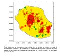 Chaleur974.jpg 969 × 905; 83 KB
-
 Championnat reunion 2009.png 351 × 377; 56 KB
-
 Circus maillardi distribution 1973-1975.png 1,037 × 964; 3.82 MB
-
 Climat Réunion.jpg 900 × 800; 281 KB
-
 ECDM 20180115 Mauritius Reunion TC-BERGUITTA.pdf 2,479 × 1,754; 1.09 MB
-
 ECDM 20180117 Mauritius Reunion TC-BERGUITTA.pdf 2,479 × 1,754; 987 KB
-
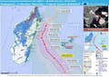 ECDM 20180306 Madagascar TC-DUMAZILE.pdf 2,479 × 1,754; 1.03 MB
-
 ECDM 20230220 TC FREDDY.pdf 1,625 × 1,125; 474 KB
-
 ECDM 20240115 TC BELAL.pdf 1,625 × 1,125; 330 KB
-
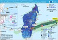
 ECDM 20241128 Indian Ocean forecast.pdf 1,793 × 1,239; 2.22 MB
-
 Etude d'impact ILO - Figure 2 - auteurs - BRL, Département 974.jpg 1,215 × 736; 198 KB
-
 Forêt semi-sèche de La Réunion.jpg 1,433 × 1,403; 219 KB
-
 France-Constituent-Lands.png 3,337 × 3,300; 382 KB
-
 France-Terres-Emergées.png 3,337 × 3,300; 299 KB
-
 GR R2 Static Map.png 600 × 751; 710 KB
-
%2C_pp._397-416.jpg/120px-La_canne_a_sucre_a_la_Réunion%2C_Armand_Colin%2C_Annales_de_Géographie%2C_43e_Année%2C_No._244_(15_Juillet_1934)%2C_pp._397-416.jpg)
-
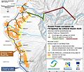
 La Réunion, schéma de développement.png 1,800 × 900; 44 KB
-
 LaRéunion2021OSM.png 7,777 × 7,166; 25.27 MB
-

-
 Map RiviereDeL'Est.jpg 3,072 × 2,592; 1.26 MB
-
 Map RiviereDesRemparts.jpg 3,047 × 2,605; 1.28 MB
-
.png/120px-Microrégion_climatiques_de_La_Réunion_(Lossec_et_Rannou).png) Microrégion climatiques de La Réunion (Lossec et Rannou).png 2,500 × 2,500; 355 KB
Microrégion climatiques de La Réunion (Lossec et Rannou).png 2,500 × 2,500; 355 KB
-
.png/120px-Microrégions_climatiques_de_La_Réunion_(Douville).png) Microrégions climatiques de La Réunion (Douville).png 2,500 × 2,500; 313 KB
Microrégions climatiques de La Réunion (Douville).png 2,500 × 2,500; 313 KB
-
 Municipales 2026 - La Réunion - Sortants.svg 1,536 × 1,362; 1.5 MB
-
 PAT - Reunion.gif 920 × 920; 136 KB
-
 Pluviométrie annuelle moyenne à La Réunion.png 2,800 × 2,800; 435 KB
-
 ReunionSat PitonDeLaFournaise.jpg 3,072 × 2,634; 1.33 MB
-
 Rigobert-Bonne-Atlas-de-toutes-les-parties-connues-du-globe-terrestre MG 9991.tif 5,230 × 3,564; 53.36 MB
-
.png/120px-Régions_bioclimatiques_de_La_Réunion_(Cadet).png) Régions bioclimatiques de La Réunion (Cadet).png 2,500 × 2,500; 605 KB
Régions bioclimatiques de La Réunion (Cadet).png 2,500 × 2,500; 605 KB
-
.png/120px-Régions_morphoclimatiques_de_La_Réunion_(Bougère).png) Régions morphoclimatiques de La Réunion (Bougère).png 2,000 × 2,000; 424 KB
Régions morphoclimatiques de La Réunion (Bougère).png 2,000 × 2,000; 424 KB
-

-
.jpg/120px-Réunion_Population_Density%2C_2000_(6171917119).jpg) Réunion Population Density, 2000 (6171917119).jpg 2,322 × 3,160; 520 KB
Réunion Population Density, 2000 (6171917119).jpg 2,322 × 3,160; 520 KB
-
 Réunion-relief trois bassins.jpg 785 × 676; 254 KB
-
 Réunion-TCO.png 861 × 743; 27 KB
-
 Saint Denis.jpg 639 × 410; 48 KB
-
_des_eaux_est-ouest.jpg/120px-Transfert_(ou_Basculement)_des_eaux_est-ouest.jpg) Transfert (ou Basculement) des eaux est-ouest.jpg 4,927 × 3,508; 1.16 MB
Transfert (ou Basculement) des eaux est-ouest.jpg 4,927 × 3,508; 1.16 MB
-
 Unesco974 perimetre2.jpg 727 × 786; 115 KB
-
 Unesco974 perimetre3.jpg 596 × 666; 83 KB
-
 Wikivoyage Reunion map PNG.png 1,044 × 1,119; 113 KB


,_pp._397-416.jpg)


.png)
.png)


.png)
.png)

.jpg)


_des_eaux_est-ouest.jpg)