
Category:Maps of New Caledonia
Departments of Metropolitan France: Ain [01] · Aisne [02] · Allier [03] · Alpes-de-Haute-Provence [04] · Hautes-Alpes [05] · Alpes-Maritimes [06] · Ardèche [07] · Ardennes [08] · Ariège [09] · Aube [10] · Aude [11] · Aveyron [12] · Bouches-du-Rhône [13] · Calvados [14] · Cantal [15] · Charente [16] · Charente-Maritime [17] · Cher [18] · Corrèze [19] · Corse-du-Sud [2A]† · Haute-Corse [2B]† · Côte-d’Or [21] · Côtes-d'Armor [22] · Creuse [23] · Dordogne [24] · Doubs [25] · Drôme [26] · Eure [27] · Eure-et-Loir [28] · Finistère [29] · Gard [30] · Haute-Garonne [31] · Gers [32] · Gironde [33] · Hérault [34] · Ille-et-Vilaine [35] · Indre [36] · Indre-et-Loire [37] · Isère [38] · Jura [39] · Landes [40] · Loir-et-Cher [41] · Loire [42] · Haute-Loire [43] · Loire-Atlantique [44] · Loiret [45] · Lot [46] · Lot-et-Garonne [47] · Lozère [48] · Maine-et-Loire [49] · Manche [50] · Marne [51] · Haute-Marne [52] · Mayenne [53] · Meurthe-et-Moselle [54] · Meuse [55] · Morbihan [56] · Moselle [57] · Nièvre [58] · Nord [59] · Oise [60] · Orne [61] · Pas-de-Calais [62] · Puy-de-Dôme [63] · Pyrénées-Atlantiques [64] · Hautes-Pyrénées [65] · Pyrénées-Orientales [66] · Bas-Rhin [67] · Haut-Rhin [68] · departmental district of the Rhône [69] · Rhône [69D]‡ · Metropolis of Lyon [69M]‡ · Haute-Saône [70] · Saône-et-Loire [71] · Sarthe [72] · Savoie [73] · Haute-Savoie [74] · Paris [75] · Seine-Maritime [76] · Seine-et-Marne [77] · Yvelines [78] · Deux-Sèvres [79] · Somme [80] · Tarn [81] · Tarn-et-Garonne [82] · Var [83] · Vaucluse [84] · Vendée [85] · Vienne [86] · Haute-Vienne [87] · Vosges [88] · Yonne [89] · Territoire de Belfort [90] · Essonne [91] · Hauts-de-Seine [92] · Seine-Saint-Denis [93] · Val-de-Marne [94] · Val-d'Oise [95]
Overseas departments and regions: Guadeloupe [971] · Martinique [972] · French Guiana [973] · Réunion [974] · Mayotte [976]
Overseas collectivities: Saint Pierre and Miquelon [975] · Saint Barthélemy [977] · Saint-Martin [978] · Wallis and Futuna [986] · French Polynesia [987] · French Southern and Antarctic Lands [984]+
Sui generis territories: New Caledonia [988] · Clipperton Island [989]+

Wikimedia category | |||||
| Upload media | |||||
| Instance of | |||||
|---|---|---|---|---|---|
| Category combines topics | |||||
| New Caledonia | |||||
French special collectivity and archipelago in Oceania  someja satełitar in marso    .svg)  | |||||
| Instance of | |||||
| Part of | |||||
| Named after |
| ||||
| Location | France | ||||
| Located in or next to body of water | |||||
| Street address |
| ||||
| Capital | |||||
| Official language | |||||
| Anthem |
| ||||
| Currency | |||||
| Head of government | |||||
| Inception |
| ||||
| Population |
| ||||
| Area |
| ||||
| Top-level Internet domain | |||||
| Different from | |||||
| official website | |||||
 | |||||
Subcategories
This category has the following 14 subcategories, out of 14 total.
Pages in category "Maps of New Caledonia"
This category contains only the following page.
Media in category "Maps of New Caledonia"
The following 63 files are in this category, out of 63 total.
-
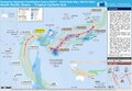
_-_DPLA_-_47d8127a32640699a51707fa7eb1a939.jpg/120px-New_Caledonia%27s_Pacific_Setting_(France)_-_DPLA_-_47d8127a32640699a51707fa7eb1a939.jpg) New Caledonia's Pacific Setting (France) - DPLA - 47d8127a32640699a51707fa7eb1a939.jpg 2,560 × 3,276; 3.64 MB
New Caledonia's Pacific Setting (France) - DPLA - 47d8127a32640699a51707fa7eb1a939.jpg 2,560 × 3,276; 3.64 MB
-
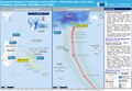
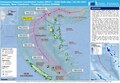
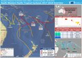
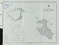
 20170410 NewCaledonia TCCook M.pdf 1,625 × 1,125; 641 KB
-
 Aire coutumière in Neukaledonien 2018.png 2018.png 3,500 × 2,971; 515 KB
-
 Carte administrative zone VKP.png 539 × 413; 9 KB
-
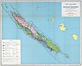
 Carte de la Nouvelle-Caledonie.svg 3,161 × 2,454; 13 KB
-
 Carte des Aires Coutumières.png 681 × 404; 273 KB
-
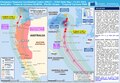
 Carte geologique de la Nouvelle-Caledonie et de ses dependances.jpg 7,642 × 6,100; 6.07 MB
-
 CircNC.jpg 622 × 443; 17 KB
-
 CircNC1.jpg 622 × 443; 18 KB
-
 CircNC2.jpg 622 × 443; 17 KB
-
 ECDM 20150108 TC ULA.pdf 1,625 × 1,125; 530 KB
-
 ECDM 20150310 tropical cyclones.pdf 1,625 × 1,125; 999 KB
-
 ECDM 20150312 PAM OLWYN.pdf 1,625 × 1,125; 471 KB
-
 ECDM 20150410 SOLO NewCaledonia.pdf 1,625 × 1,125; 854 KB
-
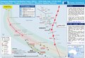
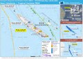
 ECDM 20170505 TCDonna.pdf 1,625 × 1,125; 667 KB
-
 ECDM 20170510 NewCaledonia TCDonna II.pdf 1,625 × 1,125; 668 KB
-
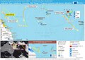
 ECDM 201800309 NewCaledonia VANUATU TC-HOLA.pdf 2,479 × 1,754; 1.1 MB
-
 ECDM 20180129 NewCaledonia TC-FEHI.pdf 2,479 × 1,754; 898 KB
-
 ECDM 20180404 Australia-Fiji TCs.pdf 2,479 × 1,754; 1 MB
-
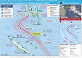
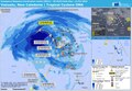
 ECDM 20180430 South-Pacific TC-Season.pdf 2,479 × 1,754; 1,024 KB
-
 ECDM 20190212 TC OMA.pdf 1,625 × 1,125; 772 KB
-
 ECDM 20190219 TC OMA update.pdf 1,625 × 1,125; 499 KB
-
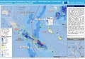
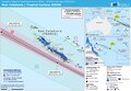
.pdf/page1-120px-ECDM_20210201_SW_Pacific_TCs(1).pdf.jpg) ECDM 20210201 SW Pacific TCs(1).pdf 1,625 × 1,125; 677 KB
ECDM 20210201 SW Pacific TCs(1).pdf 1,625 × 1,125; 677 KB
-
 ECDM 20210305 TC-NIRAN.pdf 1,625 × 1,125; 565 KB
-
 Ecoregion AA0113.png 1,172 × 1,172; 1.45 MB
-
 Fr nc kaart.jpg 476 × 345; 22 KB
-
 France-Constituent-Lands.png 3,337 × 3,300; 382 KB
-
 France-Terres-Emergées.png 3,337 × 3,300; 299 KB
-
 Karta NC Iles Chesterfield.PNG 350 × 350; 6 KB
-
 Koppen-Geiger Map NCL future.svg 1,798 × 850; 870 KB
-
 Koppen-Geiger Map NCL present.svg 1,816 × 850; 879 KB
-
 Lifou Island districts.jpg 650 × 723; 72 KB
-
 Lifou-Ouvea cgs05508.jpg 5,309 × 4,106; 14.9 MB
-
 Loyalty islands Lifou map.png 914 × 927; 113 KB
-
 Loyalty islands Lifou map.svg 922 × 936; 69 KB
-
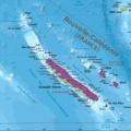
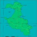
 Loyalty Islands map.png 693 × 621; 125 KB
-
 Maré Map.png 5,000 × 3,125; 850 KB
-
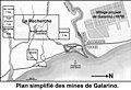 Mines de Galarino.jpg 999 × 680; 97 KB
-
 Nelle Calédonie Europ 2019.png 8,984 × 6,300; 1.42 MB
-
 Nelle Calédonie européens 2014.png 9,960 × 7,198; 2.31 MB
-
 Nelle Calédonie kanak 2014.png 9,960 × 7,198; 2.29 MB
-
 Nelle Calédonie Kanak 2019.png 8,984 × 6,300; 1.19 MB
-
 Neukaledonien Gemeindeverband 2018.png 3,500 × 2,971; 494 KB
-
_Population_Density%2C_2000_(5457016673).jpg/120px-New_Caledonia_(Fr.)_Population_Density%2C_2000_(5457016673).jpg) New Caledonia (Fr.) Population Density, 2000 (5457016673).jpg 2,507 × 3,265; 631 KB
New Caledonia (Fr.) Population Density, 2000 (5457016673).jpg 2,507 × 3,265; 631 KB
-
 New Caledonia 2.jpg 1,024 × 768; 130 KB
-
 New Caledonia administrative1-2.png 539 × 413; 19 KB
-
 New Caledonia administrative1-3.png 539 × 413; 19 KB
-
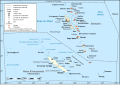
 New Caledonia and Vanuatu map-et.svg 1,024 × 718; 331 KB
-
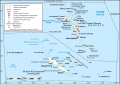
 New Caledonia and Vanuatu map-fr.svg 1,024 × 718; 358 KB
-
 New Caledonia and Vanuatu map-mk.svg 1,024 × 718; 353 KB
-
 New Caledonia and Vanuatu map-ru.svg 1,024 × 718; 359 KB
-
.jpg/120px-New_Caledonia_Population_Density%2C_2000_(6171914743).jpg) New Caledonia Population Density, 2000 (6171914743).jpg 2,324 × 3,161; 518 KB
New Caledonia Population Density, 2000 (6171914743).jpg 2,324 × 3,161; 518 KB
-
 Newcaledonia w1 locator.svg 1,000 × 1,000; 79 KB
-
 Newcaledonia w2 locator.svg 1,000 × 1,000; 190 KB
-
 NieuwCaledonieLocatie.png 250 × 115; 4 KB
-
 Nov kaledonio-mapo.jpg 343 × 339; 15 KB
-
 Pacific Ocean laea Oceanian countries map.jpg 1,165 × 1,070; 542 KB
-
 PAT - New Caledonia.gif 1,150 × 800; 43 KB
-
 Plan simplifié des travaux.pdf 1,062 × 681; 614 KB
-
 Production et exportation minière en Nouvelle-Calédonie.png 585 × 427; 225 KB
-
.jpg/120px-TDM18Gris_1_(page_19_crop).jpg) TDM18Gris 1 (page 19 crop).jpg 616 × 921; 170 KB
TDM18Gris 1 (page 19 crop).jpg 616 × 921; 170 KB
-
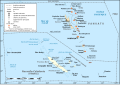
 Wallis & Futuna and New Caledonia.png 587 × 518; 93 KB
-
 Новая Каледонія.png 700 × 628; 60 KB
_-_DPLA_-_47d8127a32640699a51707fa7eb1a939.jpg)


_Population_Density,_2000_(5457016673).jpg)


.jpg)


.jpg)

