
Category:Bathymetric maps of the Pacific Ocean
Subcategories
This category has the following 2 subcategories, out of 2 total.
*
Media in category "Bathymetric maps of the Pacific Ocean"
The following 138 files are in this category, out of 138 total.
-
 Asphalt volcanoes bathymetry.jpg 1,200 × 900; 381 KB
-
 Astoria Canyon.jpg 600 × 384; 26 KB
-
_(20351461081).jpg/120px-Atoll_research_bulletin_(1987)_(20351461081).jpg) Atoll research bulletin (1987) (20351461081).jpg 3,280 × 2,262; 1.42 MB
Atoll research bulletin (1987) (20351461081).jpg 3,280 × 2,262; 1.42 MB
-
 Bathymetric map of the Hawaiian Archipelago.png 850 × 643; 1.05 MB
-
.jpg/120px-Bathymetric_map_of_the_northern_portion_of_San_Francisco_Bay_(MLLW).jpg) Bathymetric map of the northern portion of San Francisco Bay (MLLW).jpg 3,300 × 2,550; 1.2 MB
Bathymetric map of the northern portion of San Francisco Bay (MLLW).jpg 3,300 × 2,550; 1.2 MB
-
.png/120px-Bathymetry_(1).png) Bathymetry (1).png 1,091 × 1,421; 271 KB
Bathymetry (1).png 1,091 × 1,421; 271 KB
-
 Bathymetry at the western boundary of the Southwest Pacific Basin.png 2,128 × 1,793; 2.87 MB
-
 Bathymetry image of the Hawaiian archipelago.png 3,681 × 2,844; 14.38 MB
-
 Bering Sea.png 588 × 414; 55 KB
-
 BetweenErebusAndUdintsevFZs.png 1,750 × 1,090; 3.62 MB
-
 Blanco Fracture Zone.jpg 400 × 249; 21 KB
-
 Canyons off LA.jpg 720 × 511; 35 KB
-
.jpg/120px-Capricorn_Seamount-NOAA-Tectonic_features_hires_(cropped).jpg) Capricorn Seamount-NOAA-Tectonic features hires (cropped).jpg 188 × 190; 75 KB
Capricorn Seamount-NOAA-Tectonic features hires (cropped).jpg 188 × 190; 75 KB
-
 Carte topographique du Japon-fr.jpg 2,580 × 2,341; 1.13 MB
-
 Carte topographique du Japon-fr.svg 2,322 × 2,107; 3.91 MB
-
.jpg/120px-thumbnail.jpg)
-
 Chile Rise.jpg 1,985 × 1,064; 304 KB
-
 Colosseum Guyot, Tamu Massif.png 1,770 × 769; 2.01 MB
-
 Columbia River Mouth and Bar.jpg 3,957 × 2,557; 4.04 MB
-
 Coral Sea Topography.jpg 1,253 × 776; 501 KB
-
 Cortes Bank NOAA chart.PNG 552 × 305; 272 KB
-
 Cross Seamount Bathymetric.jpg 180 × 180; 21 KB
-
 Drake passage en.png 928 × 846; 237 KB
-
 Drake passage.png 930 × 847; 239 KB
-
 East Pacific Rise.jpg 2,000 × 1,293; 313 KB
-
 East-mata-3d-800.jpg 800 × 600; 96 KB
-
 EmperorSeamounts.jpg 900 × 600; 367 KB
-
 Epi-Bbathymetry.jpg 640 × 503; 114 KB
-
.jpg/120px-Expl0049_(27671691554).jpg) Expl0049 (27671691554).jpg 3,240 × 2,283; 686 KB
Expl0049 (27671691554).jpg 3,240 × 2,283; 686 KB
-
 Expl1555 - Flickr - NOAA Photo Library.jpg 1,575 × 1,082; 1.5 MB
-
 ExplorerPlateBathymetry.jpg 867 × 706; 139 KB
-
 Fig 1 Chatham Rise Map.jpg 1,578 × 1,193; 210 KB
-
 Fig 2 Bathymetry map of South China Sea Basin.jpg 3,921 × 1,902; 3.52 MB
-
 Galapagos Bathymetric.jpg 792 × 612; 152 KB
-
 Galapagos Islands topographic map-en.svg 2,160 × 2,160; 2.62 MB
-
 GEBCO 2019 bathymetry Challenger Deep and Sirena Deep.jpg 2,128 × 1,552; 973 KB
-
 Gebco 2024 n-9.1641 s-10.3846 w149.5705 e151.3736 relief.jpg 433 × 293; 30 KB
-
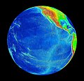
 Geography 057 - Globe with its center the Pacific Ocean.jpg 828 × 952; 64 KB
-
 Geologists Seamounts.png 821 × 787; 1.01 MB
-
 Geomap Image.jpg 948 × 553; 133 KB
-
 GodzillaElev.jpg 309 × 424; 112 KB
-
 Hawaii hotspot.jpg 1,500 × 632; 452 KB
-
 Hawaii-Emperor engl.png 2,367 × 2,400; 4.35 MB
-
 Hawaiian Islands landslides.jpg 2,208 × 1,705; 424 KB
-
 Hawaiian seamount chain.jpg 939 × 650; 164 KB
-
 HotspotTrails.JPG 344 × 389; 45 KB
-
 Hourglass morphology.png 1,091 × 1,421; 239 KB
-
 Izu Islands and Zenisu Ridge 500m mesh bathymetry.png 1,120 × 840; 1.32 MB
-
 Japan Relief Map of Land and Seabed.png 2,117 × 1,745; 7.47 MB
-
 Japan topographic blank map.jpg 3,280 × 4,480; 1.33 MB
-
 Japan-Archipelago-Outlined-Islands-Map.png 2,012 × 1,644; 3.2 MB
-
 JapanTanakaContours.jpg 500 × 336; 257 KB
-
 Kerguelen-Plateau-Topography.jpg 380 × 400; 37 KB
-
 Laysan map lrg.gif 600 × 546; 17 KB
-
 Location of SHR.png 974 × 445; 682 KB
-
 Louisville seamount chain - bathymetry.jpg 738 × 521; 212 KB
-
 Macquarie.png 2,480 × 3,509; 3.09 MB
-
.jpg/120px-Main_Line_Islands%2C_NOAA_bathymetric_map_with_lineations_(Horizon_Guyot).jpg)
-
 Main Line Islands, NOAA bathymetric map with lineations.jpg 3,300 × 2,550; 3.37 MB
-
 Map of the Sumatra Trench.jpg 946 × 549; 638 KB
-
.jpg/120px-Map00164_(27670432144).jpg) Map00164 (27670432144).jpg 600 × 789; 187 KB
Map00164 (27670432144).jpg 600 × 789; 187 KB
-
.jpg/120px-Map00257_(27670431834).jpg) Map00257 (27670431834).jpg 2,864 × 1,753; 530 KB
Map00257 (27670431834).jpg 2,864 × 1,753; 530 KB
-
 Map00326 - Flickr - NOAA Photo Library.jpg 2,792 × 1,948; 1.08 MB
-
 Mapa REMAPE.png 3,507 × 2,480; 1.92 MB
-
 MapNankaiTrough.jpg 300 × 240; 35 KB
-
 Mariana trench location.jpg 400 × 400; 59 KB
-
 Mariana trench.png 3,000 × 3,000; 2.85 MB
-
 Marianengraben.png 1,000 × 863; 1.7 MB
-
 Marquesas map-fr.svg 4,357 × 4,301; 3.09 MB
-
 Marquesas map-mk.svg 4,357 × 4,301; 3.09 MB
-
 Maug caldera bathymetry.jpg 3,693 × 2,250; 673 KB
-
 Mavericks bathymetry - cropped.jpg 722 × 512; 224 KB
-
 Mavericks bathymetry.tiff 1,275 × 1,651; 6.02 MB
-
 Mayor Island dive map.png 3,000 × 2,684; 792 KB
-
 MBNMS Davidson Map Update.pdf 3,664 × 5,433; 3.73 MB
-
_Guyot.png/120px-Micronesia_and_Marshall_islands_bathymetry%2C_Ioah_(IOAN%3B_Fedorov)_Guyot.png)
-
 Micronesia and Marshall islands bathymetry, Ita Mai Tai Guyot.png 477 × 490; 475 KB
-
_Guyot.png/120px-Micronesia_and_Marshall_islands_bathymetry%2C_Limalok_(Harrie)_Guyot.png) Micronesia and Marshall islands bathymetry, Limalok (Harrie) Guyot.png 343 × 277; 197 KB
Micronesia and Marshall islands bathymetry, Limalok (Harrie) Guyot.png 343 × 277; 197 KB
-
_Guyot.png/120px-Micronesia_and_Marshall_islands_bathymetry%2C_Lo-En_(Hess)_Guyot.png) Micronesia and Marshall islands bathymetry, Lo-En (Hess) Guyot.png 470 × 729; 712 KB
Micronesia and Marshall islands bathymetry, Lo-En (Hess) Guyot.png 470 × 729; 712 KB
-
 Micronesia and Marshall islands bathymetry, Lomilik and Ļami.png 487 × 298; 352 KB
-
_Guyot.png/120px-Micronesia_and_Marshall_islands_bathymetry%2C_Pako_(Pallada)_Guyot.png) Micronesia and Marshall islands bathymetry, Pako (Pallada) Guyot.png 585 × 506; 580 KB
Micronesia and Marshall islands bathymetry, Pako (Pallada) Guyot.png 585 × 506; 580 KB
-
 Micronesia and Marshall islands bathymetry, Ruwitūn̄tūn̄ Guyot.png 725 × 424; 683 KB
-
 Micronesia and Marshall islands bathymetry, Ujlān volcanic complex.png 827 × 572; 1.04 MB
-
_Guyot.png/120px-Micronesia_and_Marshall_islands_bathymetry%2C_Wōdejebato_(Sylvania)_Guyot.png)
-
 Micronesia and Marshall islands bathymetry, Ļemkein.png 602 × 422; 572 KB
-
 MiddleAmericaTrench.jpg 1,472 × 862; 351 KB
-
 Monowai Volcanic Center.png 2,562 × 1,884; 3.73 MB
-
 Monterey Canyon Bathymetric Chart.JPG 1,192 × 1,767; 224 KB
-
_Earthquakes_in_the_Ryukyu_Arc.png/120px-M≥6.0_(1960-2022)_Earthquakes_in_the_Ryukyu_Arc.png) M≥6.0 (1960-2022) Earthquakes in the Ryukyu Arc.png 785 × 690; 2.07 MB
M≥6.0 (1960-2022) Earthquakes in the Ryukyu Arc.png 785 × 690; 2.07 MB
-
 NASA fiordland 2009 earthquake.png 720 × 480; 363 KB
-
 Naturaliste3d.png 1,020 × 609; 339 KB
-
 NEPTUNE Canada overview map.jpg 544 × 445; 220 KB
-
 New Caledonia and Vanuatu bathymetric and topographic map-de.svg 2,980 × 2,090; 4.25 MB
-
 New Caledonia and Vanuatu bathymetric and topographic map-fr.jpg 2,980 × 2,090; 1.53 MB
-
 New Caledonia and Vanuatu bathymetric and topographic map-fr.svg 2,980 × 2,090; 4.3 MB
-
 New Caledonia and Vanuatu bathymetric and topographic map-mk.svg 2,980 × 2,090; 4.32 MB
-
 NOAA Pearl Harbor Approach Map.jpg 5,291 × 7,123; 3.78 MB
-
 North Fiji Basin NOAA.png 1,361 × 769; 2.15 MB
-
 North-mata-3d-hires.jpg 2,713 × 2,035; 3.02 MB
-
 NPS channel-islands-map.jpg 2,160 × 1,910; 587 KB
-
 Ocean maps in Northeastern Asia - ko.png 1,333 × 884; 692 KB
-
 Okhotsk.gif 600 × 720; 32 KB
-
 Okinawa trench and Okinawa trough topographic.png 800 × 800; 192 KB
-
 Okinawa trough topographic.png 800 × 800; 170 KB
-
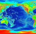 Pacific elevation.jpg 2,500 × 2,370; 899 KB
-
 Pacific elevation2.jpg 2,036 × 1,736; 1.52 MB
-
 Pacific map.gif 1,519 × 1,338; 802 KB
-
 Pacific Ocean laea relief location map frag.jpg 823 × 633; 205 KB
-
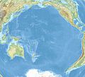 Pacific Ocean laea relief location map.jpg 1,181 × 1,074; 1.23 MB
-
 Pacific Ocean surface 1.jpg 972 × 940; 198 KB
-
 Pacific Ocean surface 2.jpg 972 × 940; 195 KB
-
 Pacific Ocean surface 3.jpg 1,119 × 940; 222 KB
-
 PacificOceanCentralAmericasGalápagosTopography.png 1,450 × 1,718; 5.66 MB
-
 Paradoxo11.jpg 1,207 × 1,401; 401 KB
-
 Patton Seamount.jpg 600 × 450; 24 KB
-
 Peru-Chile trench.jpg 573 × 1,500; 213 KB
-
 Philippine sea bathymetry He.jpg 972 × 1,136; 515 KB
-
 Philippines area map.jpg 402 × 405; 44 KB
-
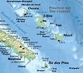 Province des Iles Loyaute bathymetric and topographic map-fr.jpg 589 × 521; 310 KB
-
 Pseudoliparis swirei in Mariana Trench map.jpg 2,008 × 1,421; 1.62 MB
-
 Ruby bathymetry map 600.jpg 600 × 639; 89 KB
-
.png/120px-S5Sbathymetry_(2).png) S5Sbathymetry (2).png 421 × 818; 411 KB
S5Sbathymetry (2).png 421 × 818; 411 KB
-
 Salmedinacartagena.jpg 815 × 600; 241 KB
-
 SamoaArchipelago.png 3,012 × 1,614; 4.29 MB
-
 Samoan Bathymetry.png 665 × 457; 533 KB
-
 Seir.png 3,509 × 2,480; 5.67 MB
-
 Tafu-Maka.jpg 430 × 480; 89 KB
-
 TamuMassifHe.jpg 900 × 600; 259 KB
-
 Tehuantepec Ridge.jpg 1,461 × 864; 817 KB
-
 The Eastern Australian abyss.jpg 459 × 772; 198 KB
-
 The Ryukyu Arc Map.png 2,400 × 2,200; 3.88 MB
-
 Vanuatu earthquakes October 2009.gif 502 × 497; 37 KB
-
 Volcano-o-3d-map-hires.jpg 2,713 × 2,035; 4.02 MB
-
 Volcano-o-cone-hires.jpg 3,430 × 2,155; 1.76 MB
-
 West Mata map.png 934 × 750; 1.58 MB
-
 Zealandia topography.jpg 1,391 × 1,617; 1.34 MB
-
 Zealandia, topographic map.jpg 1,500 × 1,700; 4.57 MB
-
 Zone di frattura del Pacifico.png 1,049 × 1,402; 4.05 MB


_(20351461081).jpg)

.jpg)
.png)


.jpg)


.jpg)


.jpg)


.jpg)


.jpg)
.jpg)


_Guyot.png)

_Guyot.png)
_Guyot.png)

_Guyot.png)


_Guyot.png)


_Earthquakes_in_the_Ryukyu_Arc.png)


.png)


